Price: $3,925,000
Size: 85.02 +/- Acres
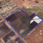
Location: The Property is located in San Luis Obispo County, in the town of Nipomo. Located east of Highway 101, the Property is at the corner of Thompson Avenue and Rancho Road. The northern boundary of the property is adjacent to the southern edge of the town of Nipomo, CA.
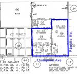
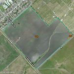
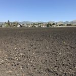
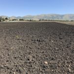
Description: The Property provides a unique combination of both agricultural and future residential development potential opportunities for long term appreciation. It consists of approximately 85 acres of certified organic irrigated farm ground in four legal parcels including 40± acres zoned Residential Single Family within the Nipomo Urban Reserve Line, with the balance zoned Agriculture. The County of San Luis Obispo has issued Certificates of Compliance for each of these four lots, assuring their validity as separate legal parcels. This efficient ranch enjoys a uniform rectangular shape, with the exception of a portion that extends beyond the rectangle to the east. The Property possesses approximately two-fifths mile of frontage along Thompson Ave. and is close to one-third mile in depth.
The Property consists of irrigated farm ground which is 100% organic certified and currently farmed to baby spinach, baby kale, baby arugula, baby spring mix, basil, chives, dill, mint, oregano, rosemary, sage, tarragon, and salanova. Additional crops grown historically include beets, kale, chard and frisee. However, the property is suitable for the growing of most vegetable and berry crops
Topography: The ranch features generally level to undulating topography in most planted areas with a gentle upward slope to the east. A small drainage runs through the southern end of the Property in an east and west direction. According to information found on the FEMA Flood Map Service Center website it is located in an area designated as “An Area of Minimal Flood Hazard-Zone X”.
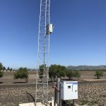
Improvements: The Property improvements consist of perimeter fencing, a radio and GPS tower, and spill slabs for above ground fuel tanks.
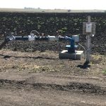
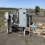
Water: Irrigation water comes from two onsite wells powered with electric pumps. Well Number 1 was developed in 1990 and finished to a depth of approximately 322 feet, with a 12″ casing. Production was last checked in September of 2016 at 180 +/- GPM. Well Number 6 was developed in 2013 with a finished depth of 755 feet with a 12″ casing. Production was last checked in September of 2016 at 220 +/- GPM.
The irrigation system consists of underground pressurized 6″ PVC mainlines with risers every 33′.
Zoning:
- 40± acres zoned RSF (Residential, Single-Family)
- 45± acres zoned AG (Agriculture)
Utilities: Power is provided by PG&E
Assessors Data: APN’s 090-051-037, 063, 064 & 065
Property Tax: 2016-2017 Property Taxes: $16,634.66
Preserve: The Property is not in the Ag Preserve (Williamson Act)

